On the Urban Renewal of Hayes Valley
06/07/26
I’ve lived in Hayes Valley for about a year and a half. It is an easy place to like. It is one of the sunnier parts of the city, the streets are full of Victorians, there are plenty of good restaurants, coffee shops, and bars, and it is a flat, short bike ride to a lot of good neighborhoods, including the Mission.
Still, something about it has always felt a bit manufactured. It reminds me of SoDoSoPa, the fake-trendy development from South Park. In Hayes Valley everything is a bit too new and nice and trendy, between the Rivian showroom, local SF chains like Souvla, and boutique outdoor clothing stores like Cotopaxi and Topo.
If you sit in Patricia’s Green, the small park in the middle of the neighborhood, you can watch the whole place go by. Fresh-faced new grads talk shop about AI. Tech yuppies climb into Waymos holding Marine Layer bags. There is a group from the Castro at the south end, and there are homeless people asleep on the benches. Everyone shares the same park, but nobody really mixes.
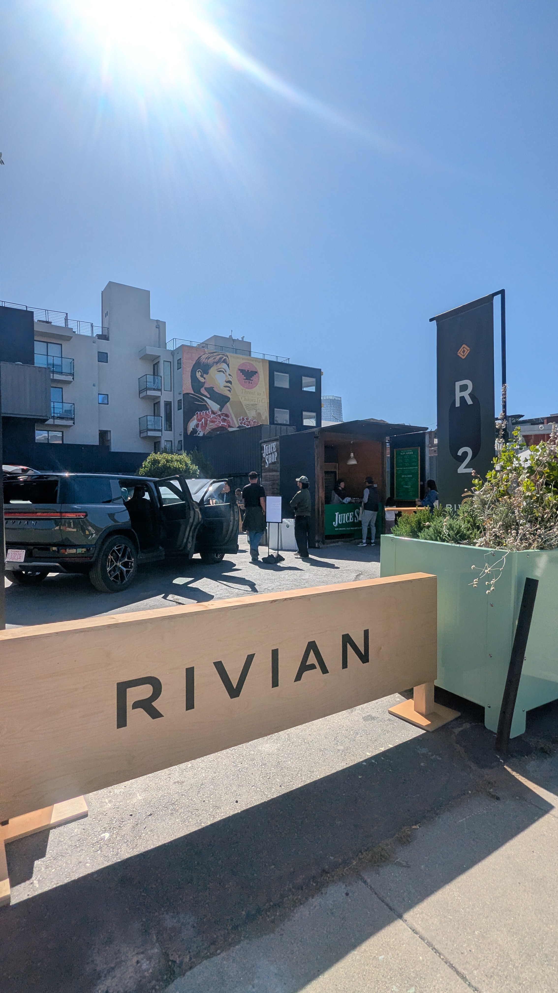
A Rivian demo in Patricia’s Green. Behind it is a mural of Cesar Chavez, who co-founded the United Farm Workers and organized California’s migrant farm workers.
As I’ve learned about the history of the neighborhood, I’ve come to better understand and appreciate how things got this way.
The Old Neighborhood
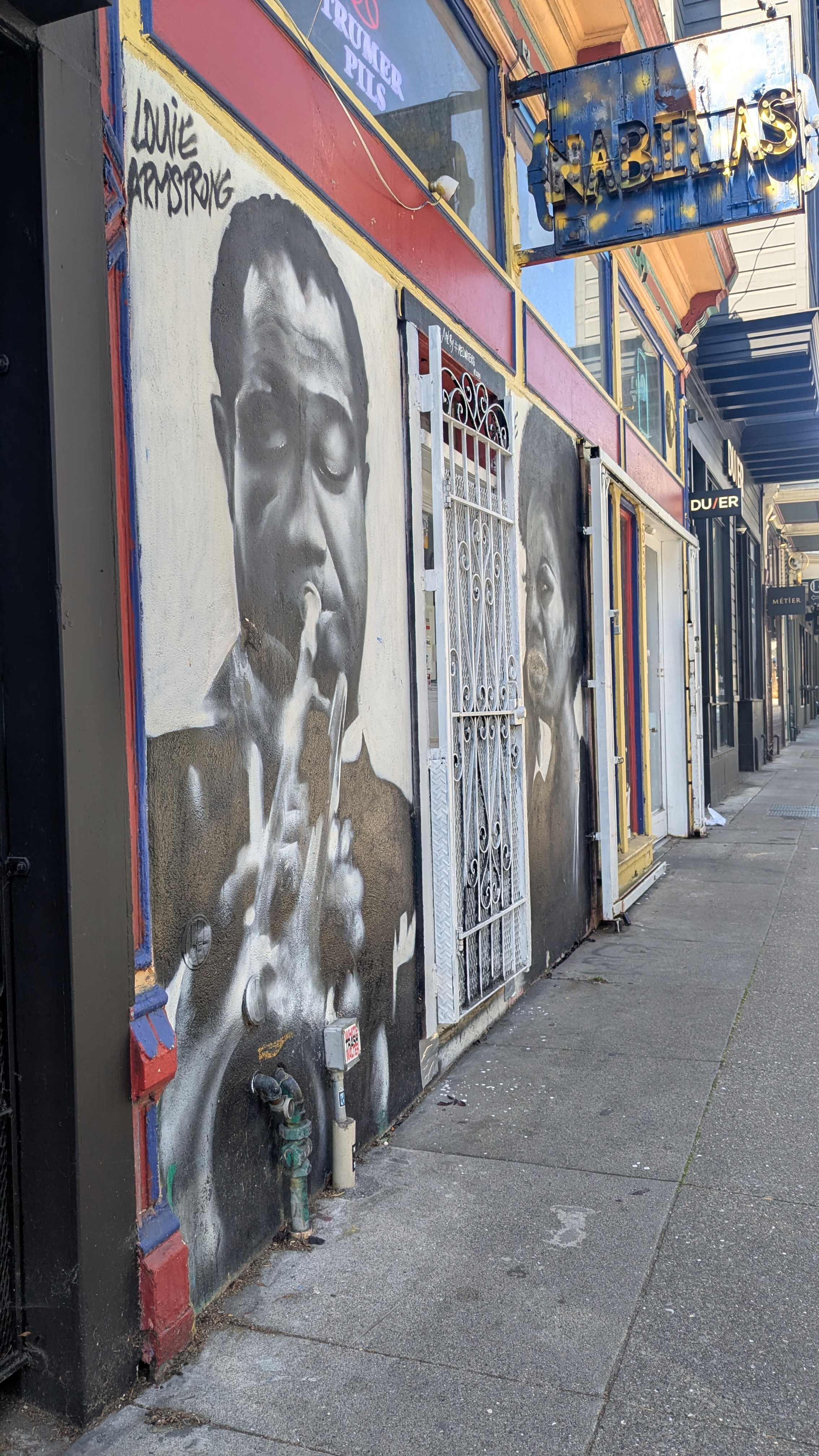
A lot of what is visible today goes back about seventy years. Hayes Valley is on the south edge of the Western Addition, which used to be a predominantly African American neighborhood in San Francisco. The blocks just north were full of Victorians, churches, and music, and the nearby part of the Fillmore was well known for jazz, with the nickname the “Harlem of the West,” where Louis Armstrong and Ella Fitzgerald played.
In the 1950s the city labeled the area “blight.” Through urban renewal, the Redevelopment Agency cleared it block by block, tore down thousands of Victorians, and moved out tens of thousands of residents, most of them African American.
The freeway came next. The double-deck Central Freeway ran over the neighborhood, and the blocks under it were rough for years. I once heard someone call this stretch “murder valley.” Into the early 1980s the area under the freeway was known for daytime prostitution and open drug sales.
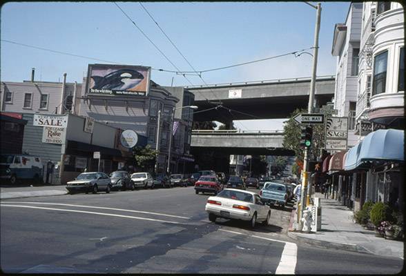
Hayes and Gough, with the Central Freeway extending over Hayes Street. Source: FoundSF / San Francisco History Center, SF Public Library.
Then the 1989 Loma Prieta earthquake damaged the freeway. After a long fight it was torn down in 2003 and replaced with Octavia Boulevard, and Patricia’s Green was built on the cleared land. The old neighborhood didn’t come back. Prices went up, the boutiques moved in, and today’s Hayes Valley grew on top of what was already gone.
That also helps explain why some other neighborhoods feel more lived-in. The Mission has gentrified too, but it was never cleared this completely, so new people had to fit into what was already there. Hayes Valley didn’t have much of that left.
That history made me think about South Minneapolis (I grew up in the suburbs outside of Minneapolis). The Central part of Powderhorn became a mostly African American, middle-class neighborhood, and then in 1959 Interstate 35W cut through and removed about fifty square blocks of it. Same decade, same idea as the Central Freeway. Decades later, George Floyd was killed in that same neighborhood.
It is easy to look at Patricia’s Green and see only the last ten years: the Rivians, the Waymos, the cold brew. But most of what is there now started with planning decisions made more than sixty years ago. Hayes Valley is a reminder of the many decades it can take for the full implications of policy decisions like urban renewal to play out.
Subscribe
Get new posts by email.